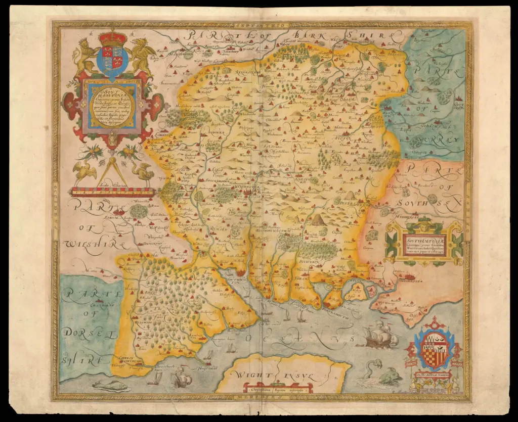
1575 – Christopher Saxton’s
Map of Hampshire

Christopher Saxton, born around 1540 and believed to have originated from Yorkshire, stands as one of the most significant figures in the history of English cartography. Working during the reign of Elizabeth I, he became the creator of the first printed atlas devoted entirely to the counties of England and Wales. His work marked a decisive transition from medieval mapping traditions toward a more systematic, survey-based representation of the landscape.
Saxton’s major achievement emerged from a commission secured in the early 1570s. The project was sponsored by Thomas Seckford, a prominent court official and trusted servant of Queen Elizabeth I. Seckford obtained royal approval and financial backing for what was an ambitious and unprecedented undertaking: to survey and map the counties of England and Wales in a coherent, engraved, and publishable form. The enterprise had official sanction from the Crown, reflecting the growing administrative sophistication of Elizabethan government and the increasing importance of geographic knowledge to the state.
Between approximately 1574 and 1578, Saxton travelled extensively to conduct surveys. While the exact methods he used are not fully documented, his maps show evidence of measured surveying rather than reliance solely on earlier manuscript sources. The resulting atlas, published in 1579, contained 34 county maps along with a general map of England and Wales. In some cases, larger counties were represented on more than one sheet. The work is commonly referred to as the Atlas of the Counties of England and Wales, though its formal presentation varied between surviving copies.
The maps were engraved on copper plates, a relatively advanced and durable printing method for the period. Flemish engravers played a key role in transferring Saxton’s surveys into printable form, notably Remigius Hogenberg and Augustine Ryther. Their technical expertise ensured clarity of line and decorative detail. The finished maps were printed in London, and many surviving copies were hand-coloured, enhancing both their aesthetic appeal and their usefulness.
Saxton’s county maps introduced a level of consistency previously unseen in English cartography. County boundaries were more clearly defined than in earlier representations. Hills were depicted using pictorial symbols, often shown as small, shaded mounds scattered across the terrain. Towns were differentiated by size and symbol, giving visual cues about their relative importance. Decorative cartouches, coats of arms, and royal insignia reinforced both the authority of the work and its connection to Elizabethan governance. Although most county sheets did not include latitude and longitude grids, the overall structure reflected Renaissance cartographic influence and an emerging concern with measured space.
Accuracy varied between counties, with some regions mapped more precisely than others. This variation likely reflects differences in available source material, surveying challenges, and local cooperation. Nevertheless, Saxton’s atlas represented the first systematic effort to map England and Wales at the county level in printed form. It moved beyond the schematic and symbolic mapping traditions of the medieval period and established a new standard for territorial representation.
The purpose of the atlas was not navigational in the maritime sense. Instead, it served administrative, political, and strategic needs. In an era of increasing centralisation under Elizabeth I, detailed geographic knowledge supported governance, taxation oversight, legal jurisdiction, and military planning. The atlas met the needs of the monarch and her court by providing a clearer visual understanding of the realm’s territorial organisation.
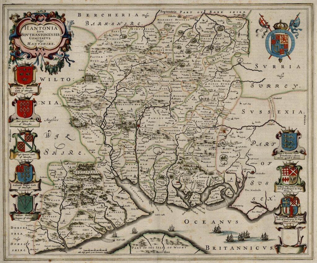
The publication of the atlas in 1579 marked a milestone in English printing and cartography. It is widely regarded as the first national atlas of England and Wales. Its influence extended well beyond its initial publication, shaping the expectations of what county maps should contain and how they should be structured. Later cartographers, including John Speed, built upon the foundation Saxton established. Speed’s early seventeenth-century county maps owe a clear conceptual debt to Saxton’s pioneering work, even as they expanded in decorative and descriptive detail.
Following the success of his atlas, Saxton benefited from royal favour. He received grants of land and continued to work as a surveyor in different parts of England. Over time, he was granted a coat of arms, marking his rise in social status and confirming his recognition as a gentleman. He is believed to have died around 1610.
Christopher Saxton’s legacy rests on the transformation he brought to English mapping. By combining survey work, skilled engraving, and official patronage, he produced a coherent visual record of England and Wales at a crucial moment in the development of the modern state. His atlas stands not only as a technical achievement but also as a reflection of Elizabethan political authority and Renaissance approaches to knowledge, measurement, and representation.