1645 – Joan Blaeu’s
Map of Hampshire

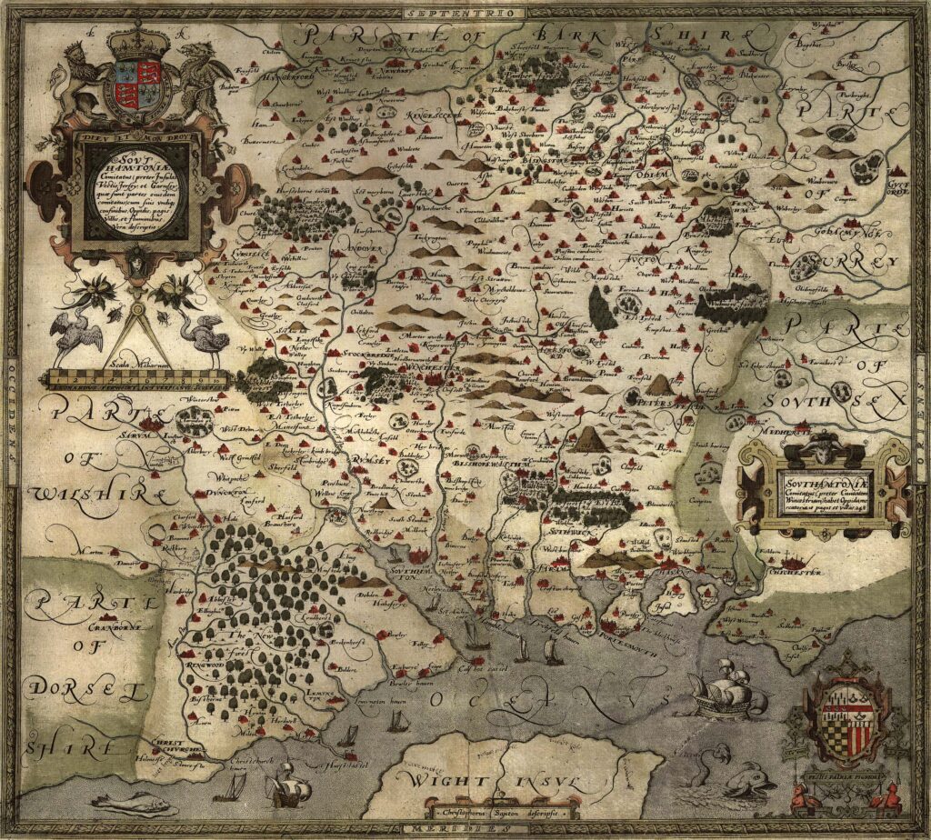
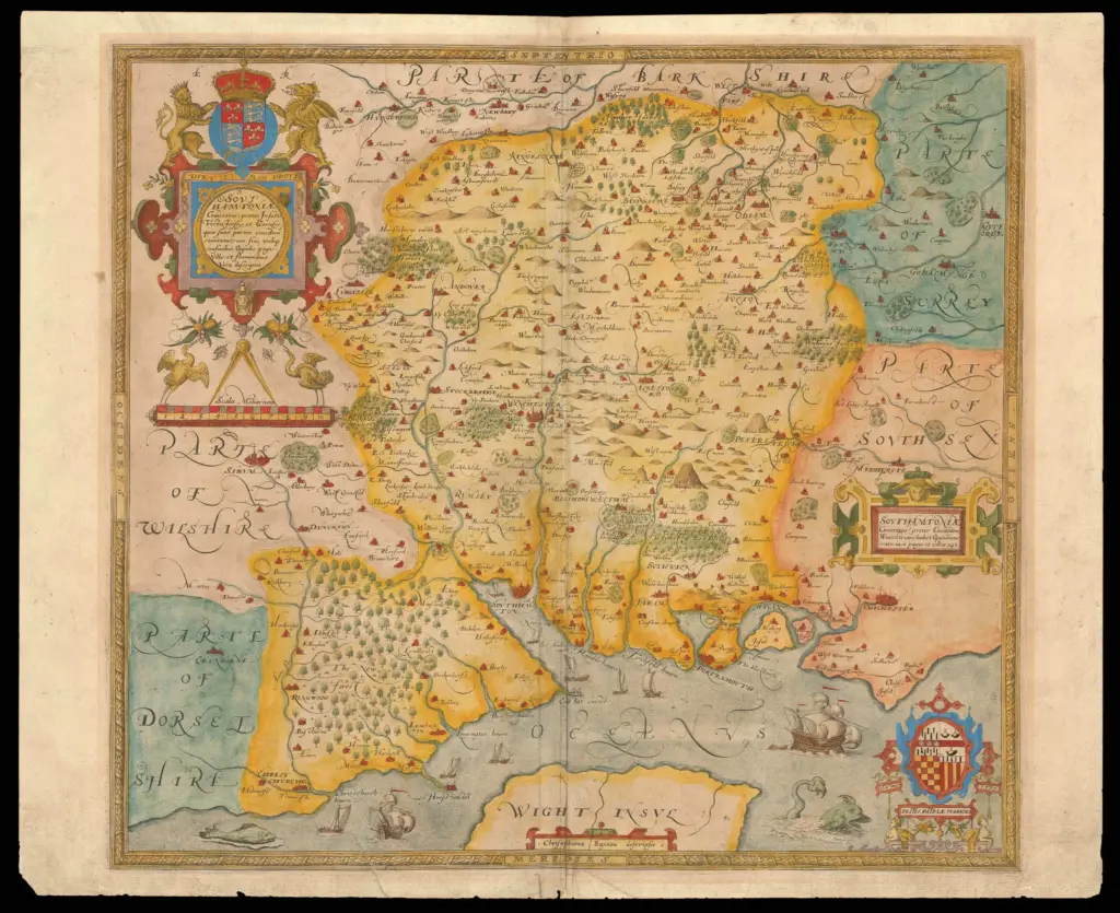
The 1645 engraved map of Hampshire was published by Joan Blaeu (1596–1673), often anglicised as John Blaeu, the Dutch cartographer and atlas publisher based in Amsterdam. Although English sources frequently refer to him as John Blaeu, his correct Dutch name was Joan Blaeu. He was the son of Willem Janszoon Blaeu, founder of the Blaeu cartographic publishing house, and assumed control of the firm following his father’s death in 1638.
The Hampshire map formed part of the English county volume of Blaeu’s Atlas Novus, issued in 1645. This atlas series was one of the most ambitious publishing enterprises of the seventeenth century and was produced for an international market. The Blaeu firm printed its maps from copperplates in Amsterdam and issued atlas editions in several languages, including Latin, Dutch, French, and Spanish. The English county maps were included within this broader world atlas project, demonstrating the incorporation of English regional geography into continental European cartography.
The map is typically titled Hampshire or the County of Southampton, sometimes also including the alternative name Hantshire. These variations reflect historical naming conventions, as the county was formally associated with Southampton while commonly known as Hampshire. Latin forms may also appear in certain editions of the atlas.
The scale of the map is approximately 3.5 miles to one inch. Unlike the earlier sixteenth-century survey work of Christopher Saxton, Blaeu’s Hampshire map was not the result of a new field survey undertaken in the 1640s. Instead, its geographical framework was largely derived from earlier English cartographic sources, particularly the county maps of John Speed. Blaeu adapted and re-engraved this material within the stylistic and structural format of his own atlas series.
The map includes a significantly greater level of detail than the earliest printed Hampshire maps. Roads are shown linking principal towns, reflecting the growing importance of route networks in seventeenth-century county cartography. Rivers such as the Test and Itchen are clearly delineated, and the coastline along the Solent and the English Channel is carefully rendered, including estuaries and inlets. Numerous towns and villages are named, with settlement symbols varying according to status.
Relief is depicted using stylised hill symbols rather than measured contour lines, consistent with prevailing engraving conventions of the period. Woodland areas and parklands are indicated, and some editions show hundred boundaries. Decorative elements are characteristic of Blaeu’s engraving style, including elaborate title cartouches and heraldic devices. These ornamental features reflect both artistic convention and the high production standards associated with the Blaeu firm.
As with most Blaeu atlas maps, colouring was applied by hand after printing. The intensity and quality of colouring vary between surviving copies, depending on whether the atlas volume was issued as a standard edition or a more elaborate presentation copy. Higher-quality examples often show carefully applied washes to boundaries, coats of arms, and decorative features.
The Hampshire sheet was issued as part of a bound atlas rather than as a separately commissioned county survey. Its publication in 1645 represents the transmission of English cartographic knowledge into the broader European atlas tradition. While geographically dependent on earlier English sources, the map reflects the technical refinement, engraving quality, and international distribution characteristic of mid-seventeenth-century Dutch mapmaking.