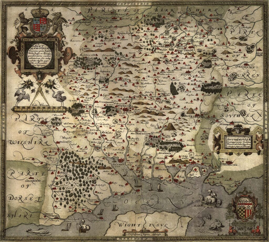
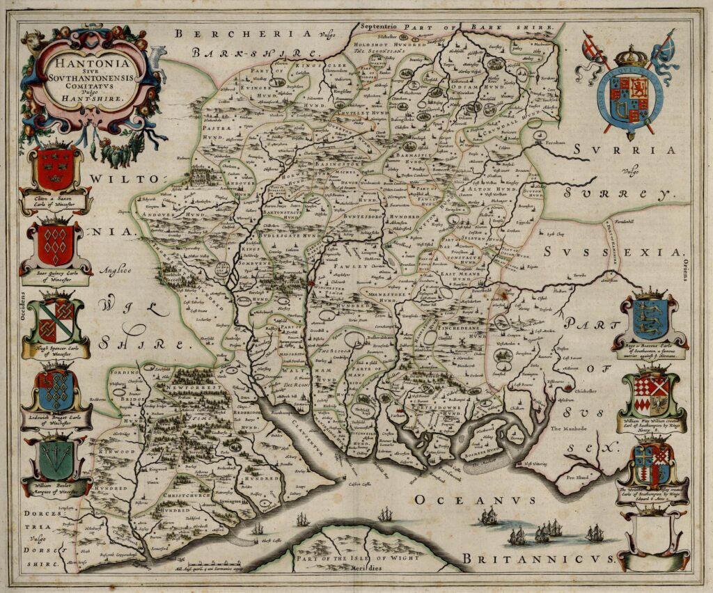
1810 – Ordnance Survey’s
Map of Hampshire

The Ordnance Survey began systematic national mapping in the late eighteenth century in response to concerns over possible French invasion during the Revolutionary and Napoleonic Wars. Initial military surveying focused on the south coast of England, considered the area most vulnerable to attack. Survey work commenced in Kent and progressed westward along the coastline.
The one-inch to one-mile map series, later known as the Old Series, was the first comprehensive topographic mapping of southern Britain produced by the Ordnance Survey. The Hampshire mapping was published in 1810 at the scale of one inch to one mile (1:63,360). Coverage of Hampshire was distributed across eight engraved sheets: 8, 9, 10, 11, 12, 14, 15 and 16.
The Old Series maps were engraved on copperplates and printed in monochrome. Relief was shown using hachures to indicate slopes and terrain form rather than contour lines, which were not yet standard on one-inch mapping. The maps provided detailed topographic information including:
– Settlements and accurately recorded place names
– Turnpike and principal roads
– Rivers, streams and drainage features
– Coastal configuration and tidal waters
– Woodland and heathland
– Selected man-made features such as mills and bridges
The surveys were based on triangulation, building on the Principal Triangulation of Great Britain initiated in the 1790s. This scientific framework allowed for a higher degree of positional accuracy than earlier county maps. Fieldwork involved measured baselines and angular observations, creating a geodetic structure onto which topographic detail was added.
Unlike earlier privately published county maps, the Ordnance Survey mapping was a government undertaking under the Board of Ordnance. Its primary purpose was strategic and military, though the maps quickly proved valuable for civil administration, transport planning, and land management.
The Hampshire sheets formed part of the earliest continuous mapped corridor along the southern counties of England. By 1810, this represented one of the most accurate and systematically surveyed depictions of the county produced to that date. The Old Series one-inch maps established the standard scale that remained central to British national mapping for much of the nineteenth and twentieth centuries.
The 1810 Hampshire sheets therefore mark a transition from commercial county cartography to state-directed scientific survey, combining military necessity with emerging standards of geodetic precision.