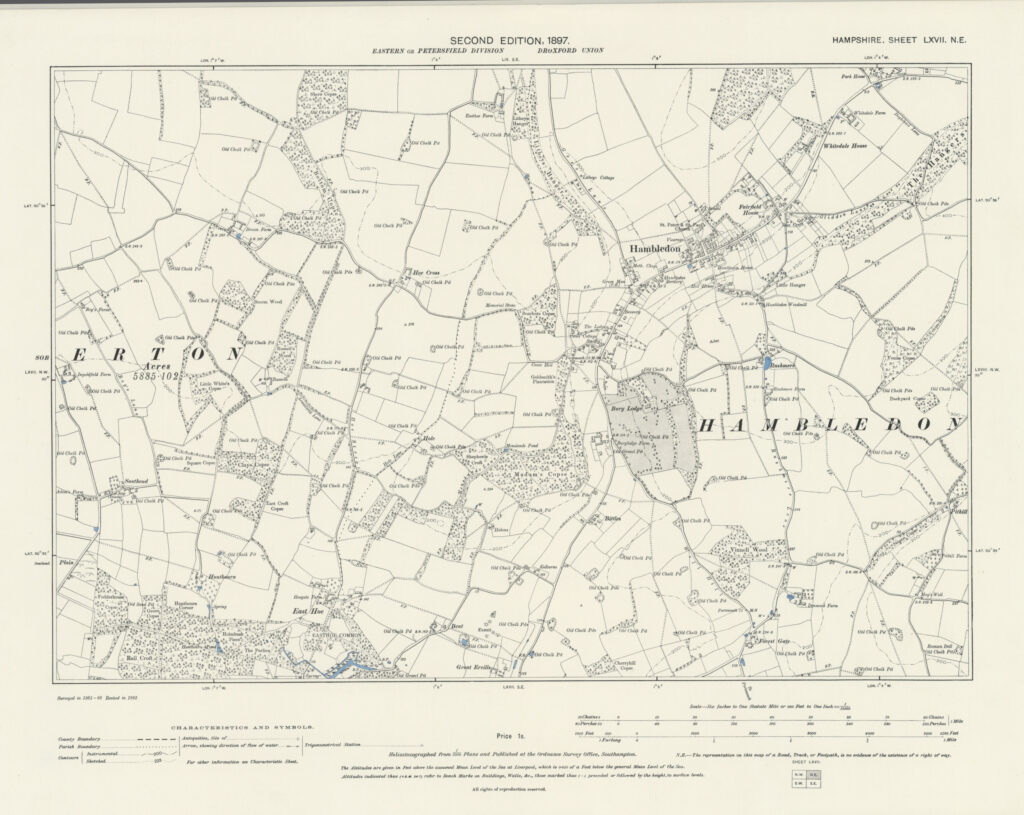
1897 – Ordnance Survey
The Ordnance Survey Second Edition maps of Hampshire, published in 1897, were based on a systematic revision carried out in 1895. This revision updated the earlier First Edition large-scale surveys…
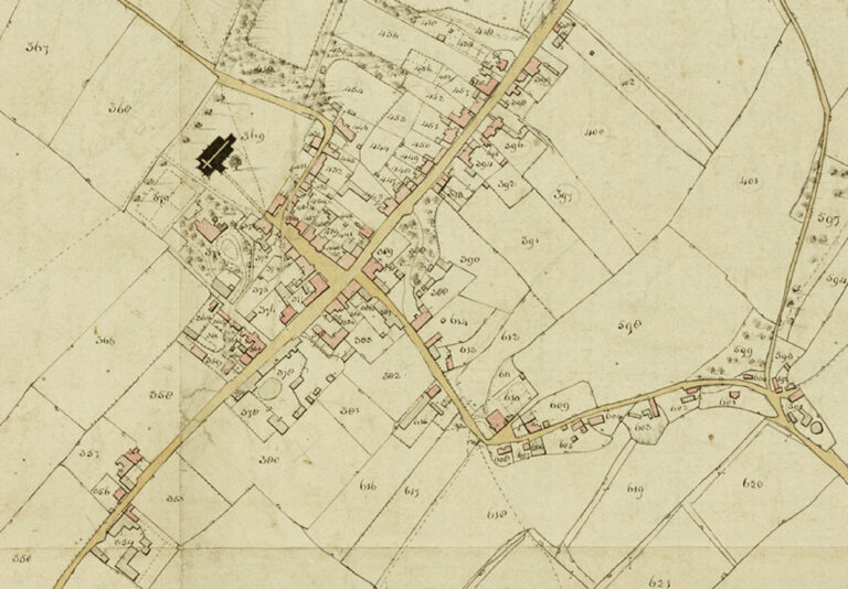
1842 – The Tithe Map
Tithe maps were produced following the Tithe Commutation Act of 1836, legislation passed to reform the long-established system by which a tenth of agricultural produce was paid to support the…
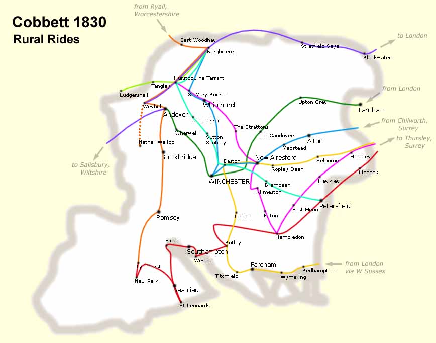
1826 – William Cobbett
William Cobbett was born in 1763 at Farnham, Surrey, the son of a farm labourer. In early adulthood he enlisted as a foot soldier and served in North America between…
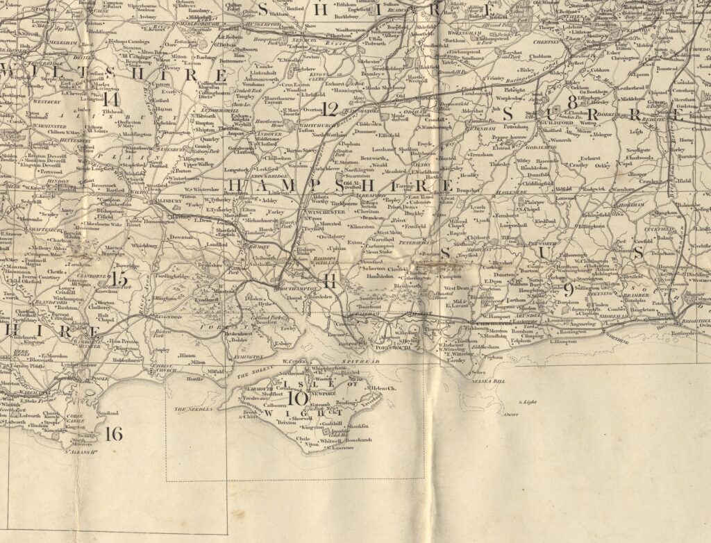
1810 – Ordnance Survey
The Ordnance Survey began systematic national mapping in the late eighteenth century in response to concerns over possible French invasion during the Revolutionary and Napoleonic Wars. Initial military surveying focused…
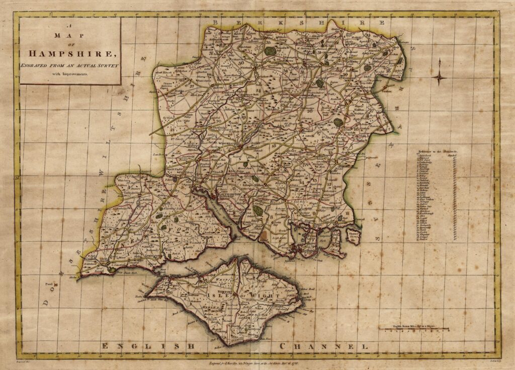
1788 – John Harrison
The Hampshire county map issued by John Harrison was first published on 16 December 1788 and later included in his 1791 atlas of England and Wales. Harrison was a London…
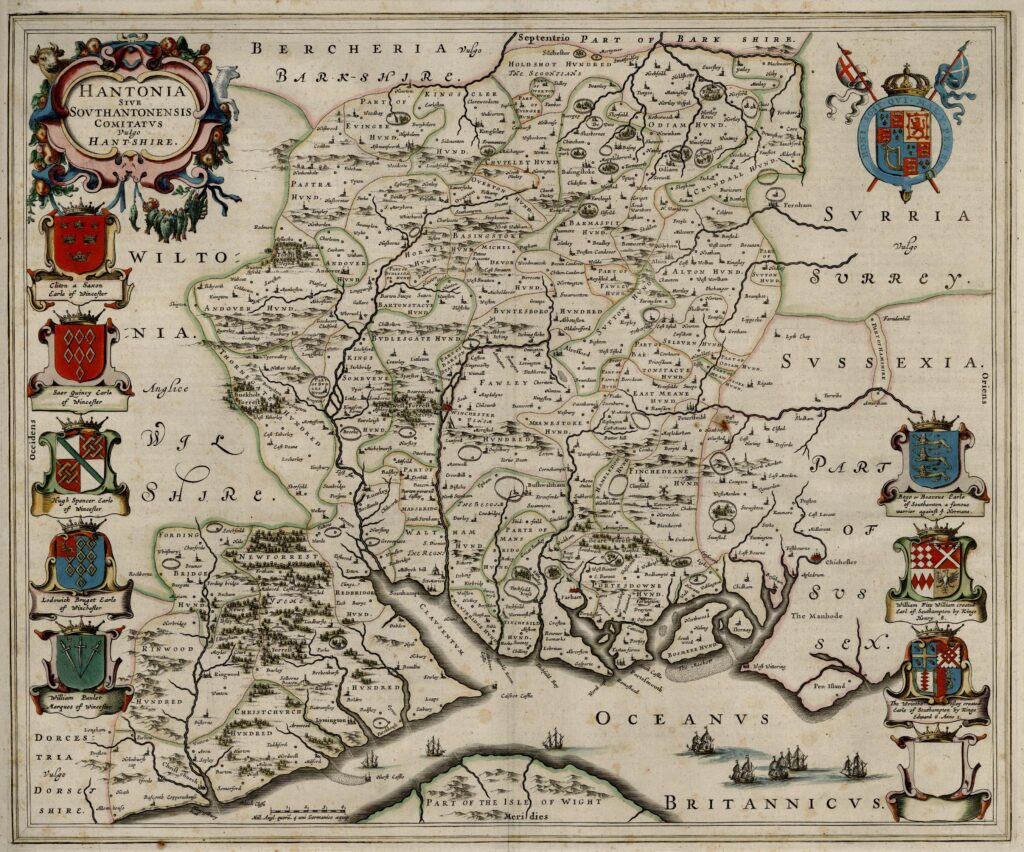
1645 – Joan Blaeu
The 1645 engraved map of Hampshire was published by Joan Blaeu (1596–1673), often anglicised as John Blaeu, the Dutch cartographer and atlas publisher based in Amsterdam. Although English sources frequently…
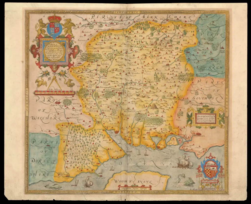
1579 – Christopher Saxton
Christopher Saxton’s map of Hampshire, titled Southamtoniae, was engraved around 1575 as part of his systematic survey of England and Wales. The copperplate for the county was prepared during the…
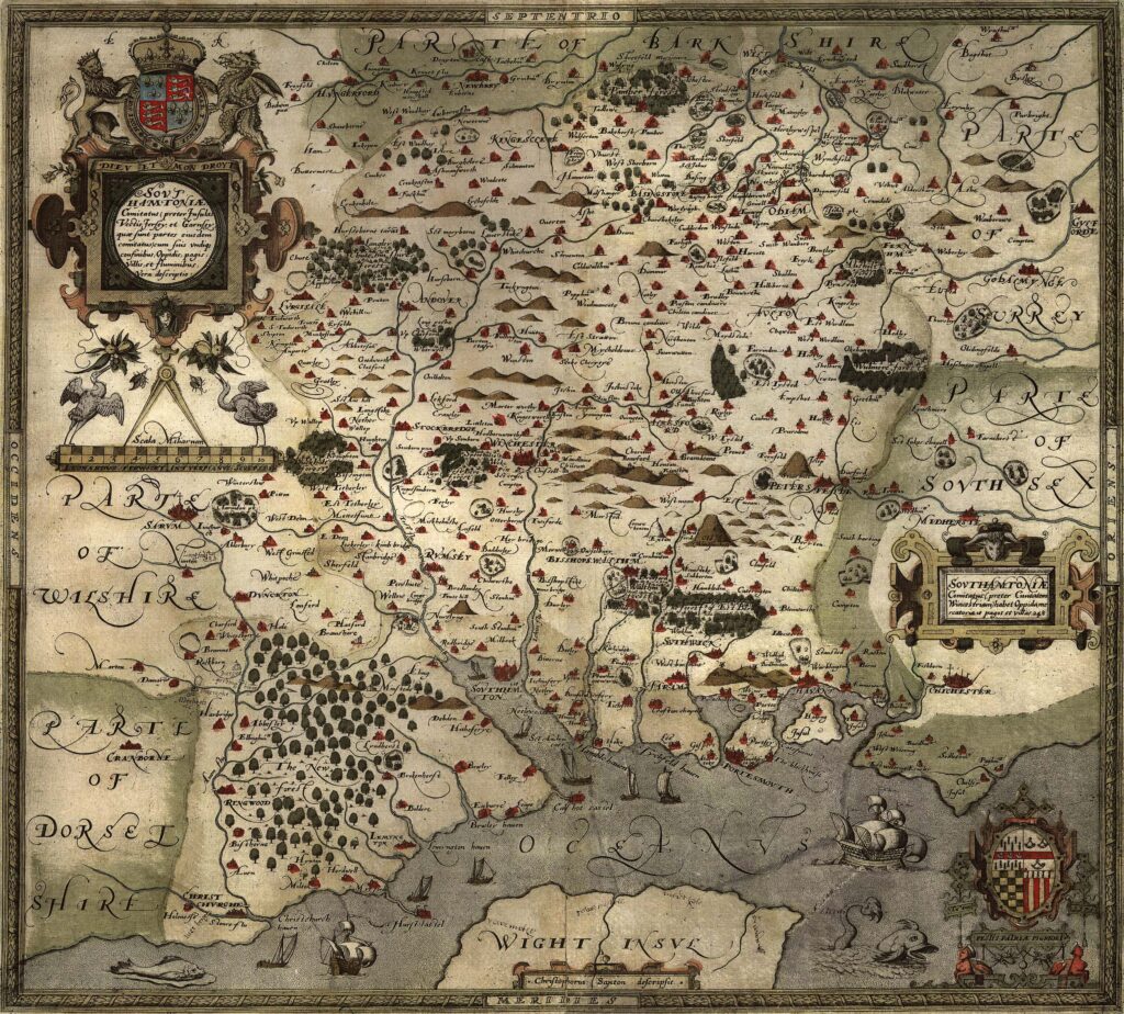
1575 – Christopher Saxton
Christopher Saxton, born around 1540 and believed to have originated from Yorkshire, stands as one of the most significant figures in the history of English cartography. Working during the reign…